
Via Baltica (Via Baltica)
Lit. the Baltic Way, or E67, a 1630-to-1722-km highway*, originally running 970 km from Warsaw to Tallinn, now from Prague to Helsinki. The section inside Estonia is known as Road (Riigitee, lit. state road) No 4 Tallinna–Pärnu–Ikla. Not to be confused with the Baltic Way / Chain (‘way’ in Lithuanian [kelias] and Latvian [ceļš], ‘chain’ in Estonian [kett]), the demonstration of 1989-08-23 when some 2 million people from the above 3 countries formed a 690-km human chain from Tallinn to Vilnius on the 50th anniversary of the Molotov-Ribbentrop Pact, leading to their independence. August 23rd is now Black Ribbon Day, or European Day of Remembrance for Victims of Stalinism and Nazism. The original starting-point in Tallinn, km 0, was Viru väljak, but 60-ton artics strolling through the city centre proved not to be the most appealing tourist trap, so the E67 was re-routed in 20XX and now follows the route below, northwards from the Laagri-Tallinn border near the old stone bridge (Pääsküla kivisild) on the Pääsküla river to Tallinna Sadam, or Port of Tallinn:
- Pärnu maantee
- Vabaduse puiestee
- Männiku tee
- Pärnu maantee
- Järvevana tee
- Peterburi tee
- Smuuli J. tee
- Narva maantee
- Reidi tee, with northbound sliproad to Tallinn harbour D-Terminali Ooteala (waiting area)
- Ahtri tänav
- Mere puiestee
- Sadama tänav
- Logi tänav, whence it enters the western section of the port zone and Reisiparvilaevade Kai (passenger-ferry quay, lit. traveller raft ship quay; users should not worry about the parv (raft) part of the word, it functions as a modifier for the large number of visitors who flock to Tallinn)
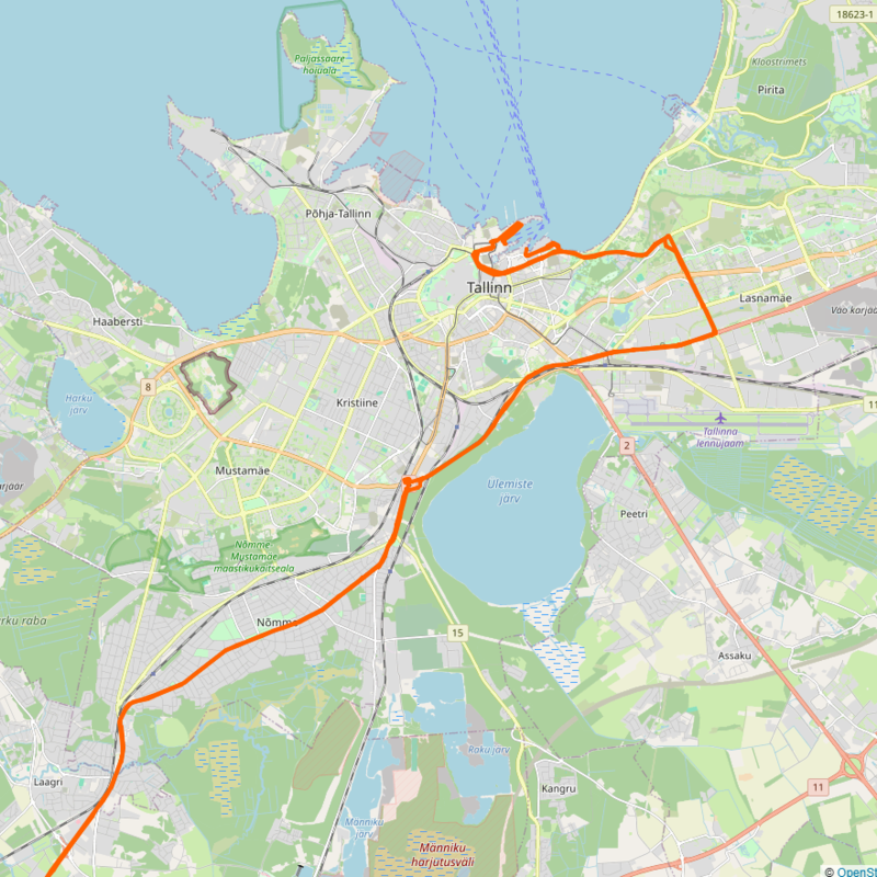
* Actual length depending on calculations including the Białystok section in Poland, ferry distances, etc.