
Eið-type locations
Showing the breadth of use and variations of meaning across the Norse world.
Article pending final review, please signal errors to Simon (@), with thanks!
Map of Eið-type locations in the Norse world
 Click here or anywhere on the map to open the full-size interactive map
Opens in a new tab; click any point for its name, type and photo.
Notes and abbreviations:
If known, earlier Norse names are listed first in italics, their modern-day counterparts and regional information beneath
- OWN = Old West Norse (Norway, Iceland, Faroes, NW British Isles)
- OEN = Old East Norse (Sweden, Denmark, E England)
- OG = Old Gutnish (Gotland)
- D† = recorded in Danish clerical Latin
Dagaið (OG)
Hiiumaa, Estonia
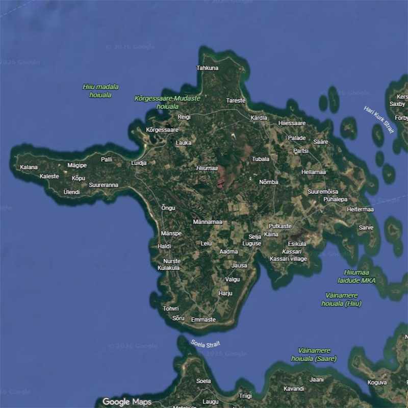
We start here, with a simple map of the island; all evidence points to a ‘point’ at the W tip of the Kõpu peninsula.

Narigeth (D†)
Naissaar, Estonia
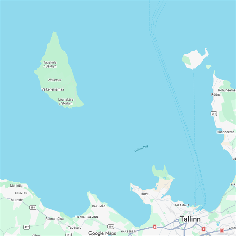
Naissaar has a history of name change: Narigeth (1250), Nargheten (1297), Nargheyden (1348), Narieden (1433), Narrie (1553), etc., plus Nargö in Swed. and Nargen in Ger., of very uncertain etymology. A suggested cognate of Finn. nurkka, Est. nurk (corner), while not impossible, is too tenuous to assert; and Narig- has been accused of proximity to Sámi njárga (cape or headland) which would generate a bilingual doubling with the -eth suffix but it’s hard to give credence to such a northern import when Estonia’s closer neighbor Finnish already had its established niem doing the same job. One tempting proposal which seems to have gained little momentum is Wieselgren’s 1951 derviation from Finnish narka (narrow) supported by his assertion of a possible Germanic loan. This would probably be West Germanic *narwaz (narrowness), which also produced Middle Dutch nare, along with nari / neri from which the former Swedish province of Närke is derived (for the narrow inlets typical of its geography). The town of Narva has similar 'narrowness' (of something) claims too, although disputed. But whither the invasive 'g'? It does fit a possible Baltic pilots’ naming device of re-using known name types which already had a 'g', for example Fyghelde and Hangethe. This could then result in a 'Narrow Point' designation, but the narrowness would not be readily visible for boats arriving from a westerly direction. The question remains open.
Further, for those insisting on a narg base – whether Naissaar, lit. Women Island, is based on Adam of Bremen's Terra feminarum (land of women) or not – it opens another MLG bag of worms for it being the equally fantastic Odyssean 'Nowhere Island' (from nargen <nīrgen, nirgen, niergen, etc. for 'nowhere', or even Noland? The puns write themselves).
Eiði (OWN)
Eiði, Eysturoy, Faroes
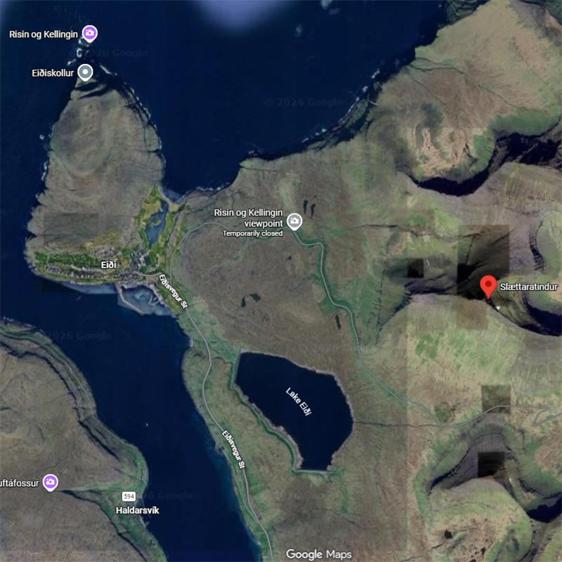
At the N tip of the islands, and some 4.25 km as the puffin flies (9.5 by sheep) from Slættaratindur, their highest peak, located at the N tip of the sound separating Eysturoy from Streymoy, this would make it an ideal point to navigate towards and make initial landfall from Iceland; there’s a sorta isthmus to its N, a bay on its S, it could be a portage point for a 400-m crossing to Niðara Vatn and thence to the N coast, and the landmass to its N & W could be a headland.
Eiðsvik
Viðoy, Faroes
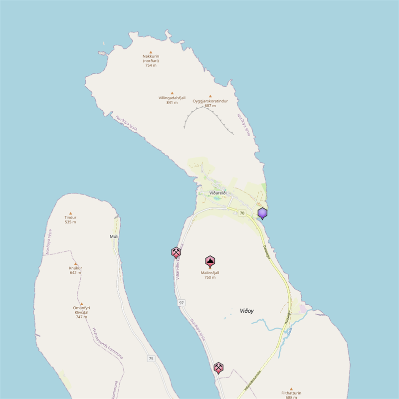
Bay on the E of Viðareiði, likely the ‘other’ end of a portage route.
Gøtueiði
Eysturoy, Faroes
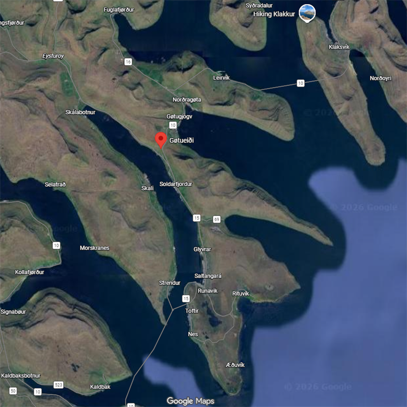
Likely a portage route across a narrowish (1.5 km) isthmus.
Lambareiði
Eysturoy, Faroes
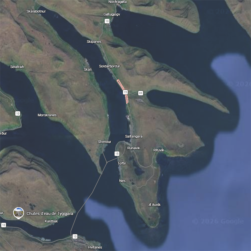
Likely a portage route across a narrowish (1.5 km) isthmus.
Vágseiði
Vágur, Faroes
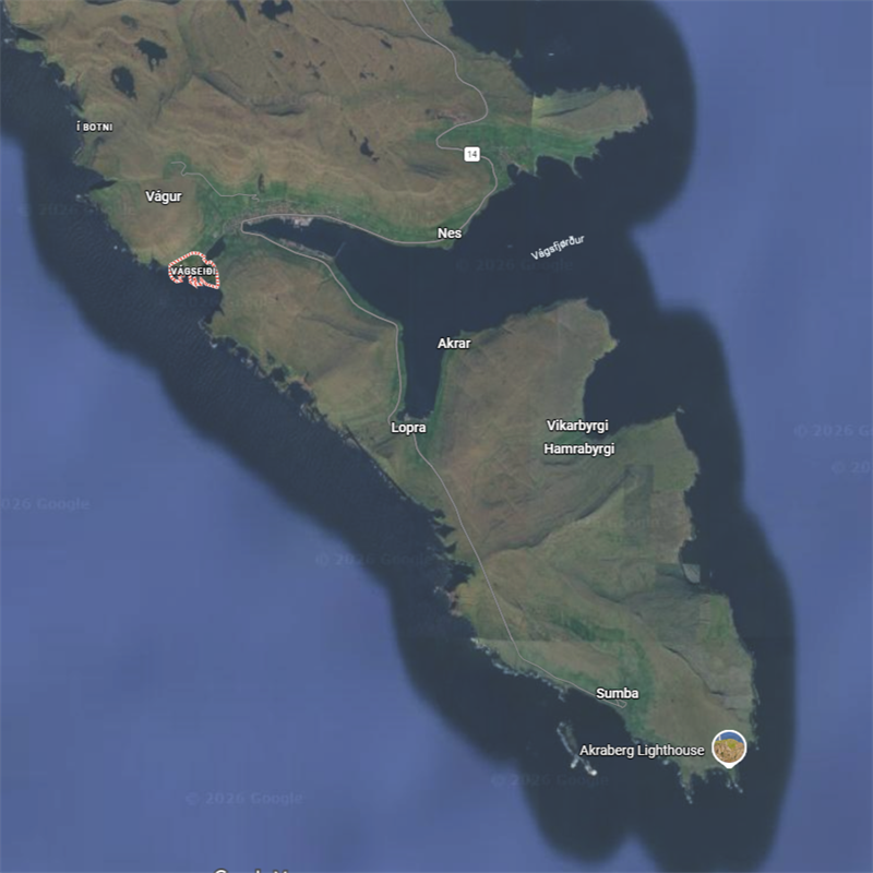
Bay on the W of Vágur, possibly the start of a portage to Vágsvatn (lake) and thence to Vágsfjørd.
Viðareiði
Viðoy, Faroes
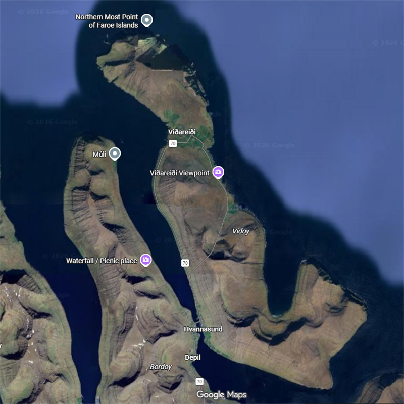
Possible isthmus or low-elevation portage across the island saving maybe 10 km by sailing around, see Eiðsvik.
Edesberget
Uusimaa, Finland
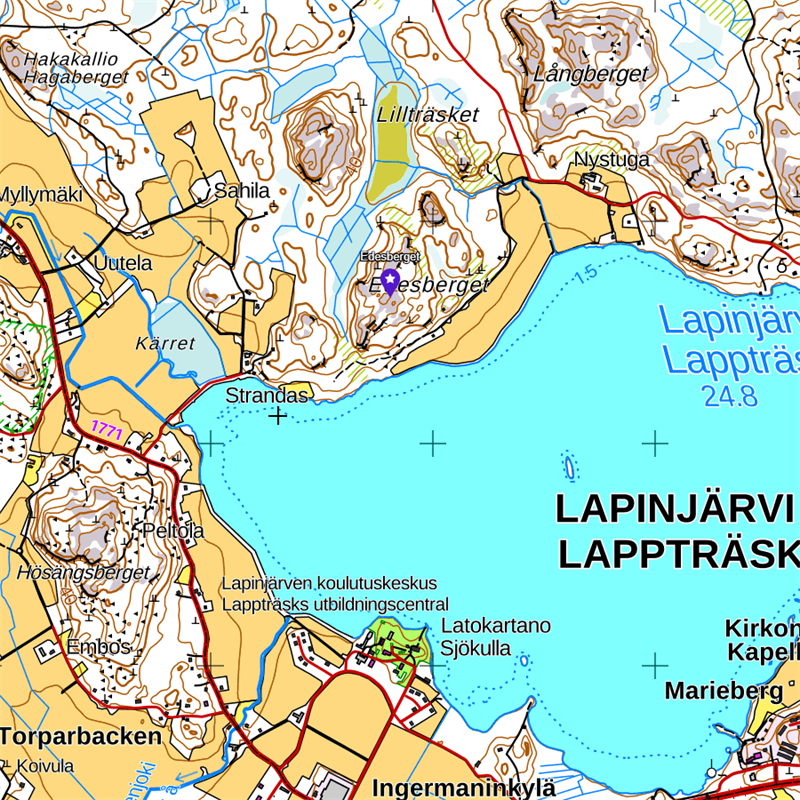
Nothing unequivocally clear.
Edesviken
Hanko, Finland
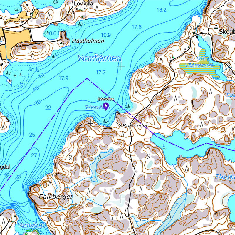
Looks like a bay, but could be a portage point for a 200-m crossing from Norrfjärden to Skogbyträsket (lake).
Fyghelde (D†)
Föglö islands, Åland, Finland
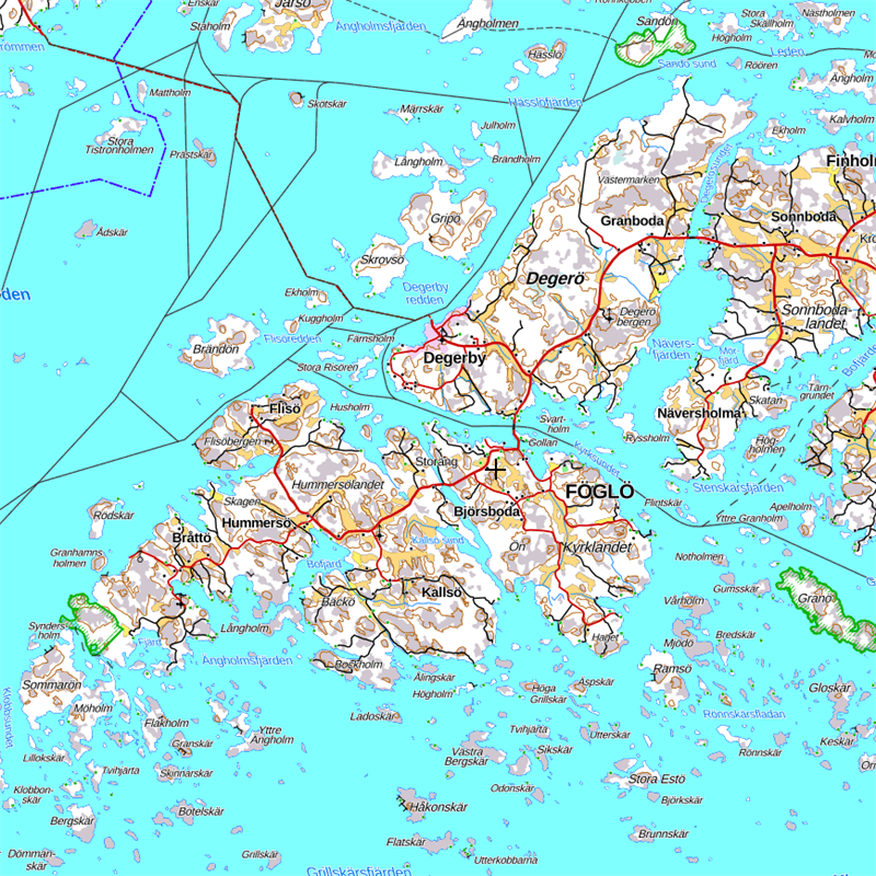
Mentioned in King Valdemar’s Itinerary. Fygh prob. derives from Old Swed. fogh(i)l, fughl, (cf. Eng. fowl) for bird; while the elde may be cognate with Hangethe’s suffix, as seems to be the case with other Finnish locations such as Järsö > Jersedhe in Åland and Gullö > Gullædhe. some 25 km NE of Hanko. While disputed, what is certain is that, like Dagaið, its ending later switched to Swedish ö, adding to the ‘island’ trope, and raising two issues: 1) being an island group could also make the singular suffix a red herring; but 2) being an island group with up to 100 scattered islets could also convey the notion of generalized zone of navigational caution simplified into a single waypoint marker.
Hangethe (D†)
Hanko, Nyland, Finland
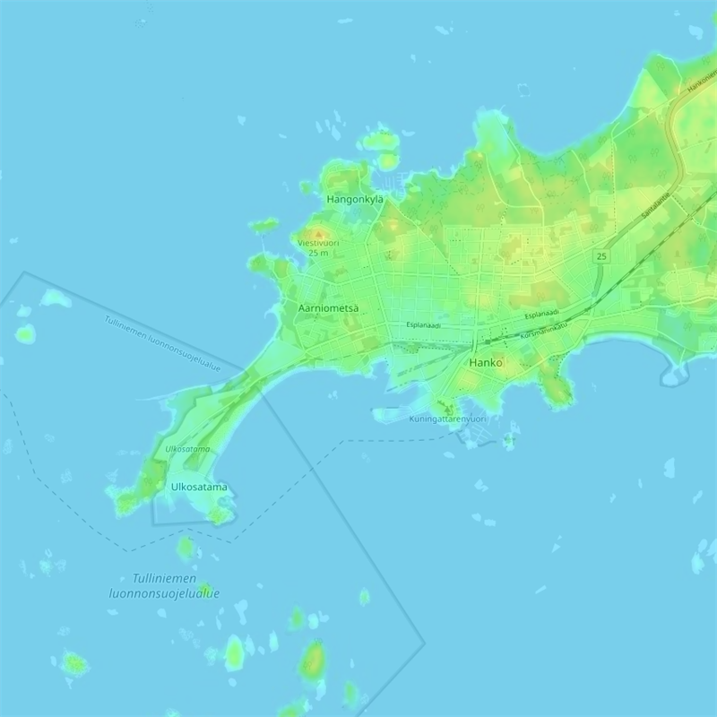
Here we have bays, isthmuses and a modest headland, it’s SW point no higher than ±10 m; the Finnish name is said to derive from hanka, ‘bifurcated peninsula’, itself perhaps from another meaning, oarlock, which the southernmost tip could resemble; the presence of Russarö Lighthouse some 3 km S of the peninsula suggests the location was long known as a shipping hazard; Hangethe has also been translated as Hango promontory[1]
[1] Westerdahl, C. (1990). The maritime itinerary of the tax register of king Valdemar Sejr of Denmark (1202-1241). Deutsches Schiffahrtsarchiv, 13, 325-375. https://nbn-resolving.org/urn:nbn:de:0168-ssoar-54126-4.
Raumedet
Pargas, Finland
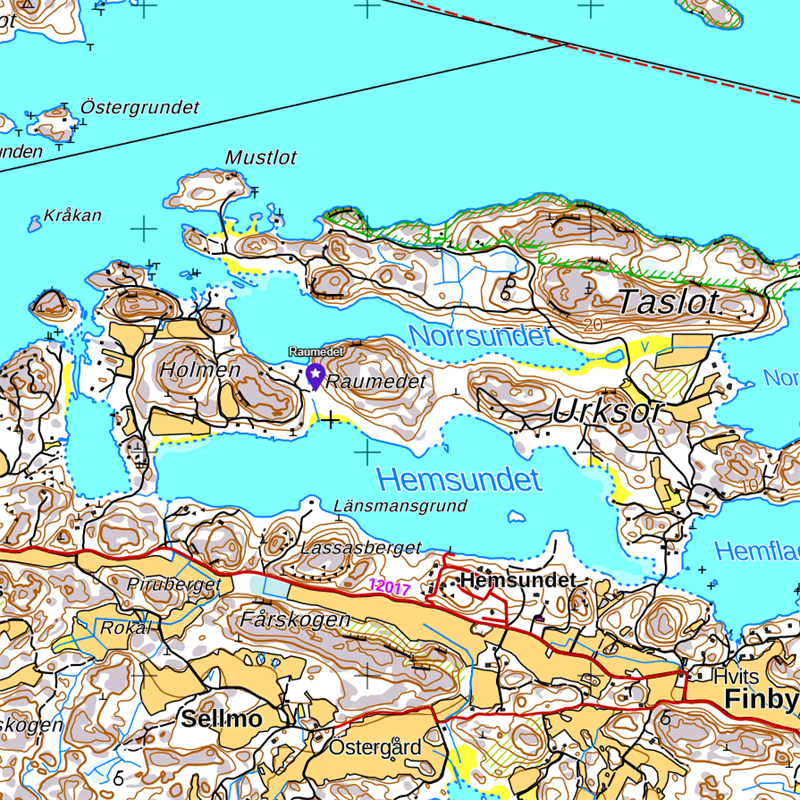
Officially an isthmus, it could also refer to a possible 200-m portage between Hemsundet and Norrsundet, but Finnish map positions the name over the elevation (headland?) to its E.
Salsedet
Pargas, Finland
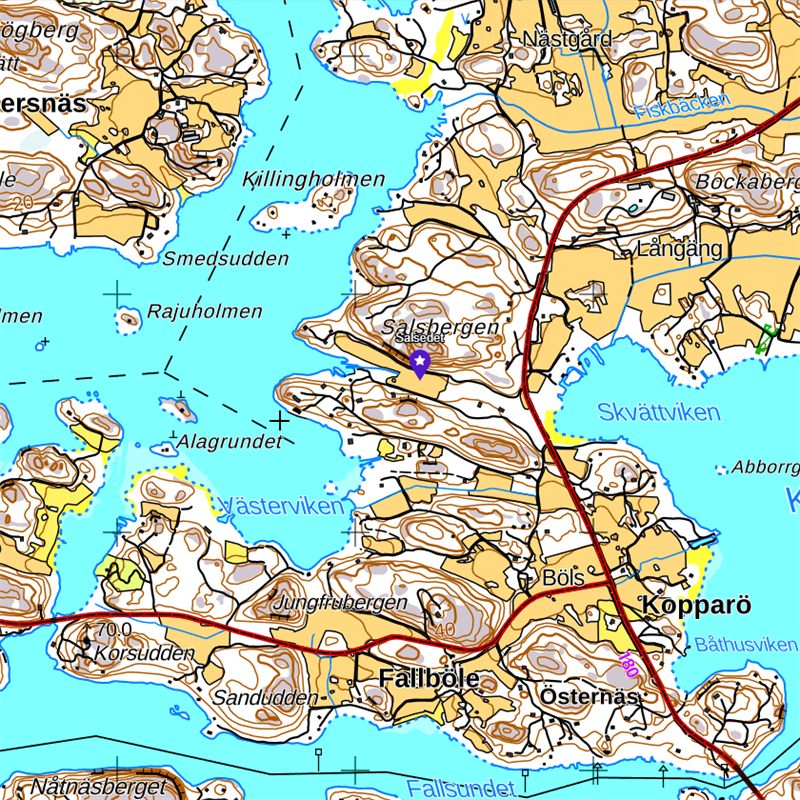
Now farmland, but likely named after an earlier portage route between Norrsundet and Skvättviken.
Taslot Edet
Pargas, Finland
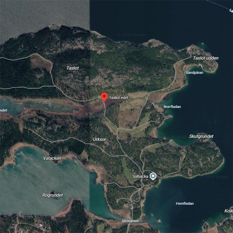
Ambiguous, could be a double bay, an elevation, a portage, or even an occasional tombolo… uncertain.
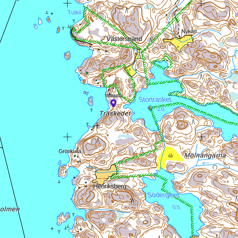
Träskedet
Biskopsö, Finland
Träskedet
Kakskala, Finland
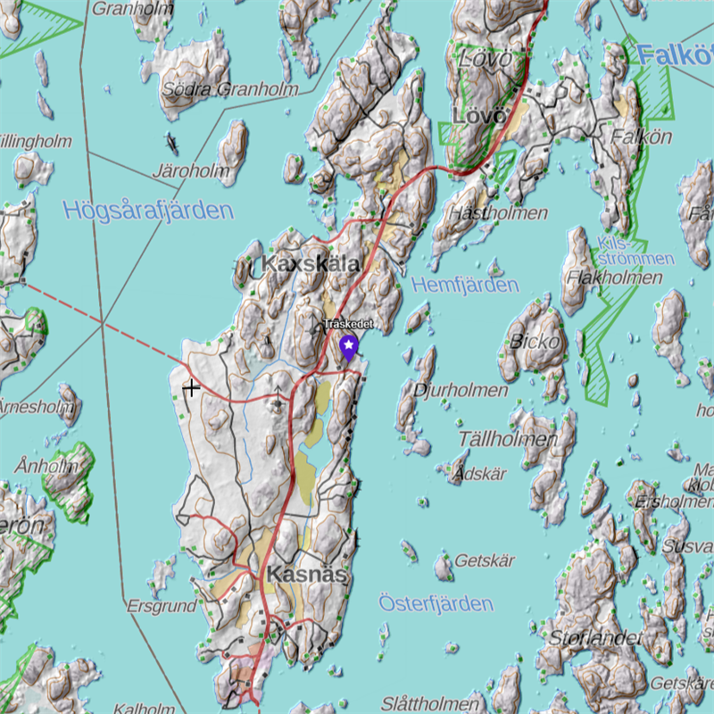
Bay with possible headland.
Eiðar (OWN)
Eiðar, Austurland, Iceland
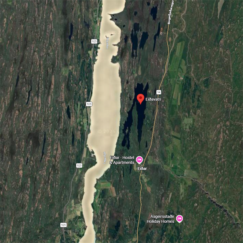
Eið names can also refer to settlements located on or near a strip of land between two lakes, here Lagarfljót and Eiðavatn; likewise, Icelandic place names involving landscape features or settlements such as this are often plural.
Eiði
Reykjavík (borderline), Iceland
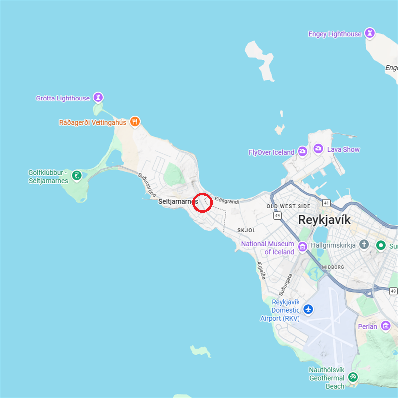
After a historical farm, generally considered to be the originator of local eið-based placenames; could be named for the peninsula, isthmus, bays or headlands.
Eiðsgrandi
Reykjavík, Iceland
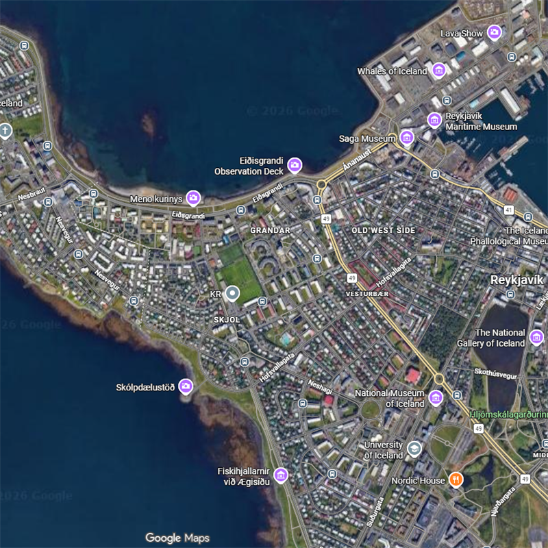
Seems to mean the gravel bay close to the original farm; ‘grandi’ means gravel, here designating the type of tombolo.
Eiðsvik
Reykjavík, Iceland
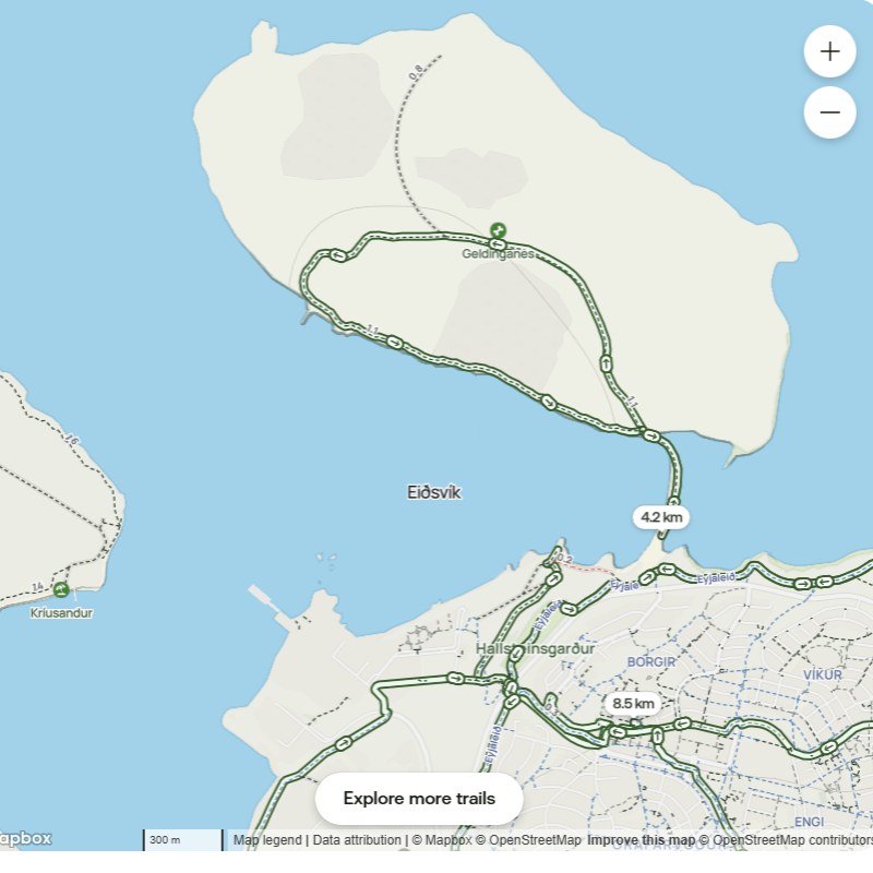
Bight W of a tombolo between mainland Grafarvogur and Geldingarnes island, historically crossable at low tide. The name Eiðsvik seems part of a larger Kollafjörd which includes another Eiðsvik (+Eiðssker), N of Eiðsgrandi.
Eið (OWN)
Eiði(ð), Suðurland, Iceland
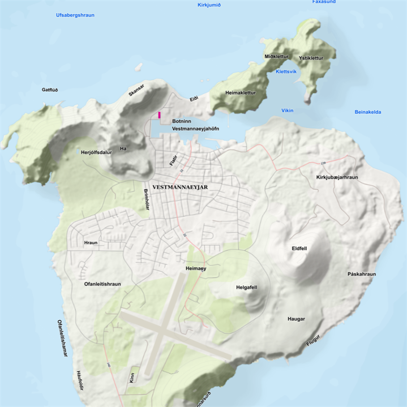
A one-time gravel tombolo on the N of Vestmannaeyjar (Westman Islands), named after the probably Irish slaves killed there þar sem Eið heitir í eyjunum (±at a place on the islands called Eið).
Eiða-fjörðr (OWN)
Eidfjord, Vestland, Norway
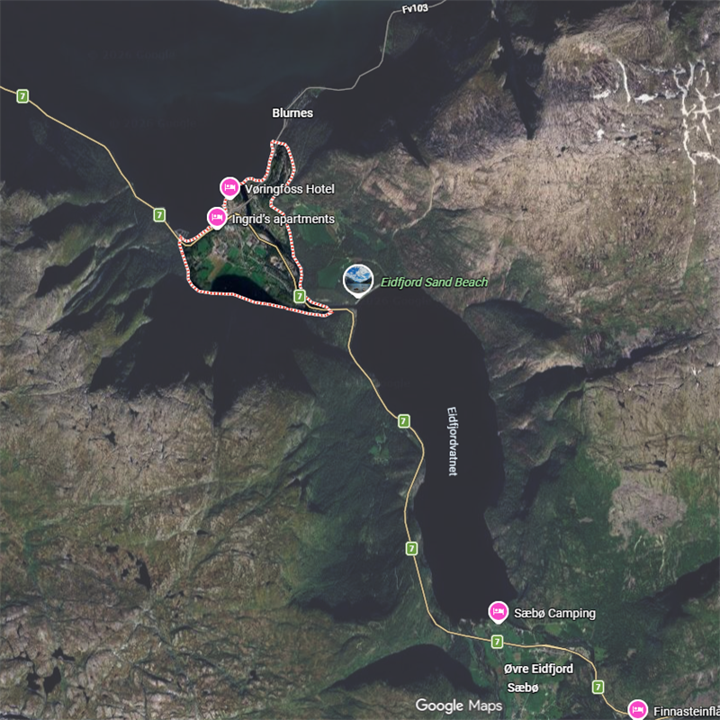
Seems clearly to be an isthmus or neck of land but could also be named for the narrow, 1-km channel / portage leading from Hardangerfjord to Erdfjordvatnet (lake).
Eiðs-berg (OWN)
Eidsberg, Østfold, Norway

Nothing clear-cut or obvious here; one of the rarer names which has been suggested to come from its other meaning of ‘oath’; local lore had it that court clercs met at a nearly knoll to swear them... For others, the name is related to portage along Norway’s longest river, the Glomma, but this too, being about 4 km away, seems unlikely. On the other hand, there being more than one Eidsberg side by side opens other avenues: the one to the NW is close to Lekumfoss (waterfall [blue circle]) on a tributary to Glomma, site today of the Lekum Kraftwerk hydroelectric power plant using a 32-m water drop to generate >4.5 GWh electricity per anmum... Not the sort of place many people would paddle upstream or down…
Eiða-skógr (OWN)
Eidskog, Innlandet, Norway
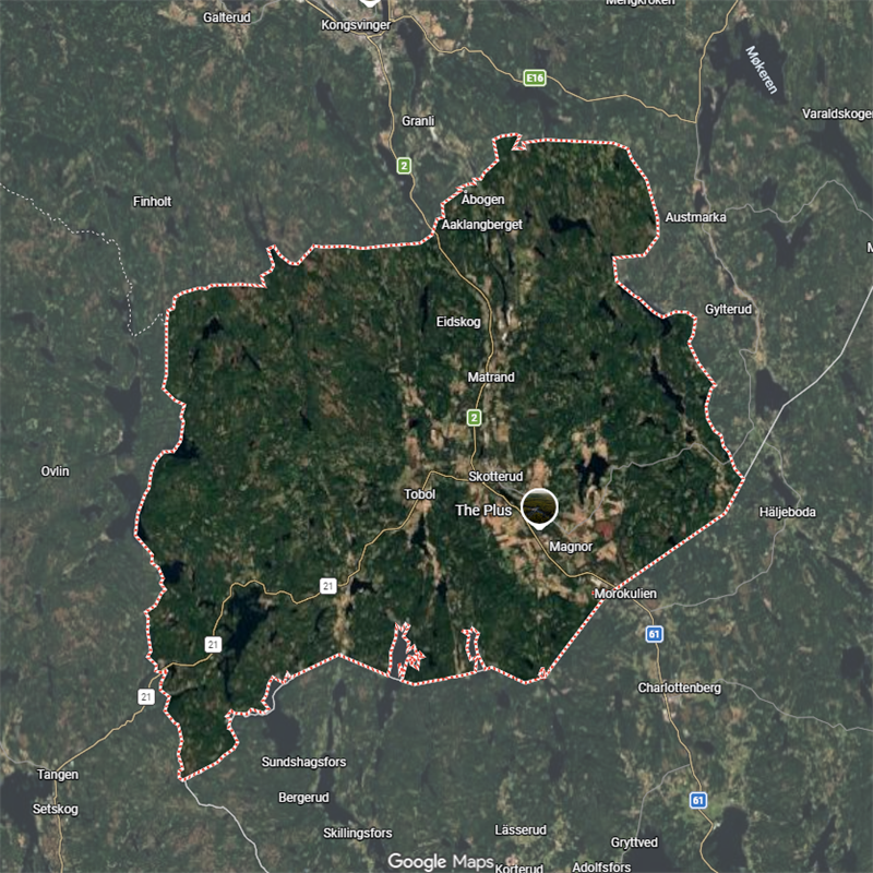
Lit. ‘eið wood’, located close to Store Gaustadsjøn (lake), depending on river level, width, or possible rapids, sounds like a point of portage through the woods between more navigable stretches of water up- or downstream, uncertain.
Eiðs-vágr (OWN)
Eidsvåg, Møre og Romsdal, Norway
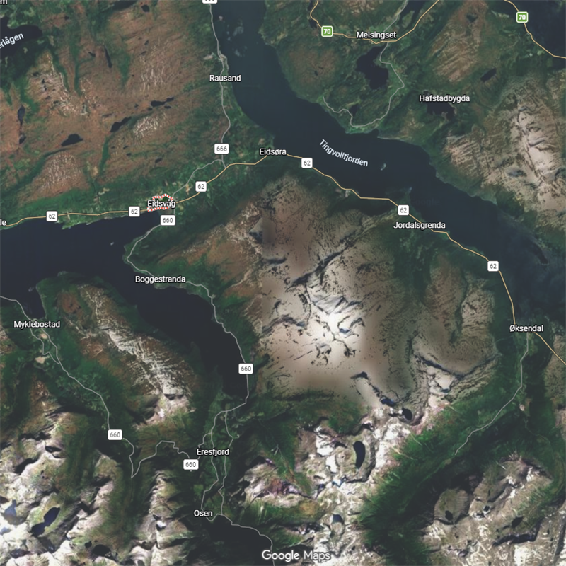
Eið + vágr, way or inlet (see Aith, Bressay), but with an Eidsøra; eið + øra, gravel, 4 km NE, almost certainly a portage to/from Tingvollfjord.
Eidsvik
Vestland, Norway
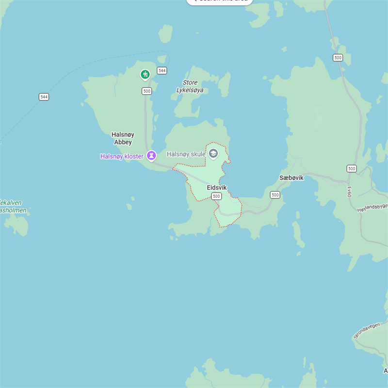
Helpfully described as ligger på et tynt, smal eid-lignende halvøy (located on a thin, narrow eid-like peninsula), the original designation may well have referred to the narrow isthmus.
Eidsvoll
Akershus, Norway
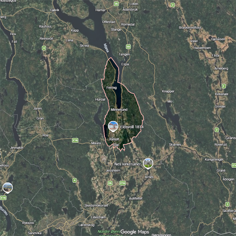
Located on a major N-S watercourse, possibly one of those occasions where it’s named for the water between two landmasses, or perhaps a portage site.
Eið (OWN)
East Aith, Stromness, Orkney
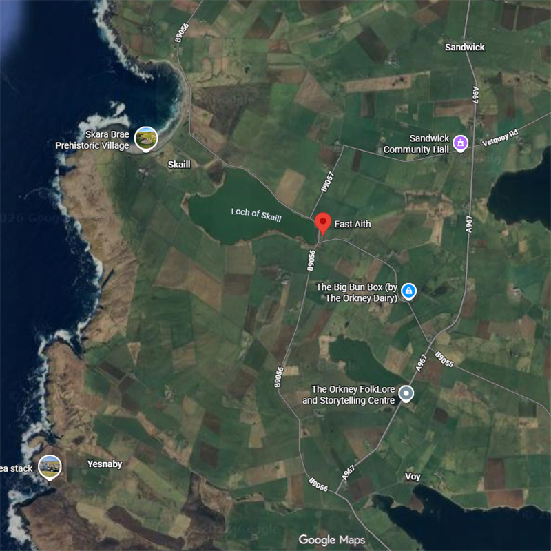
A possible site of portage between its own Loch of Skaill and the sea and Lochs Stenness and Harray, but seems a lot of work for little benefit.
Eið (OWN)
Eday, Orkney
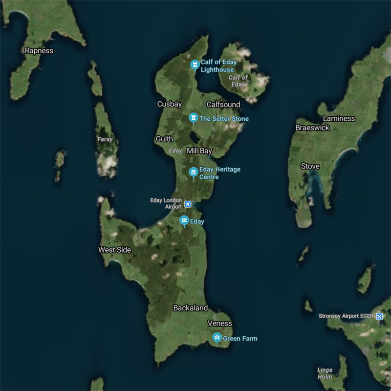
Two names, both the island itself and a bay at the NW of Mill bay; said to mean isthmus island, so it could have been named for the neck of land between the N & S halves, but also for the bays on either side.
Haugeið (OWN)
Hoxa, Orkney
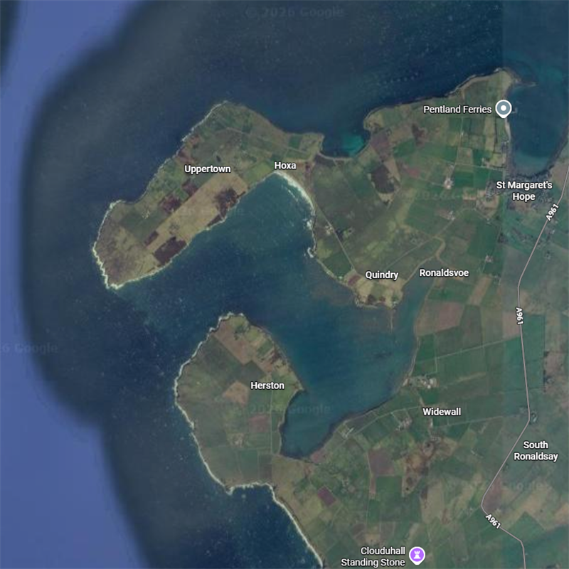
Haugeið = cairn eið, could be an isthmus on a peninsula but the cairn itself could also be the nautical marker or reference point (see Träskedet, Biskopsö).
Skalp-eið / Skálpeið (OWN)
Scapa, Orkney
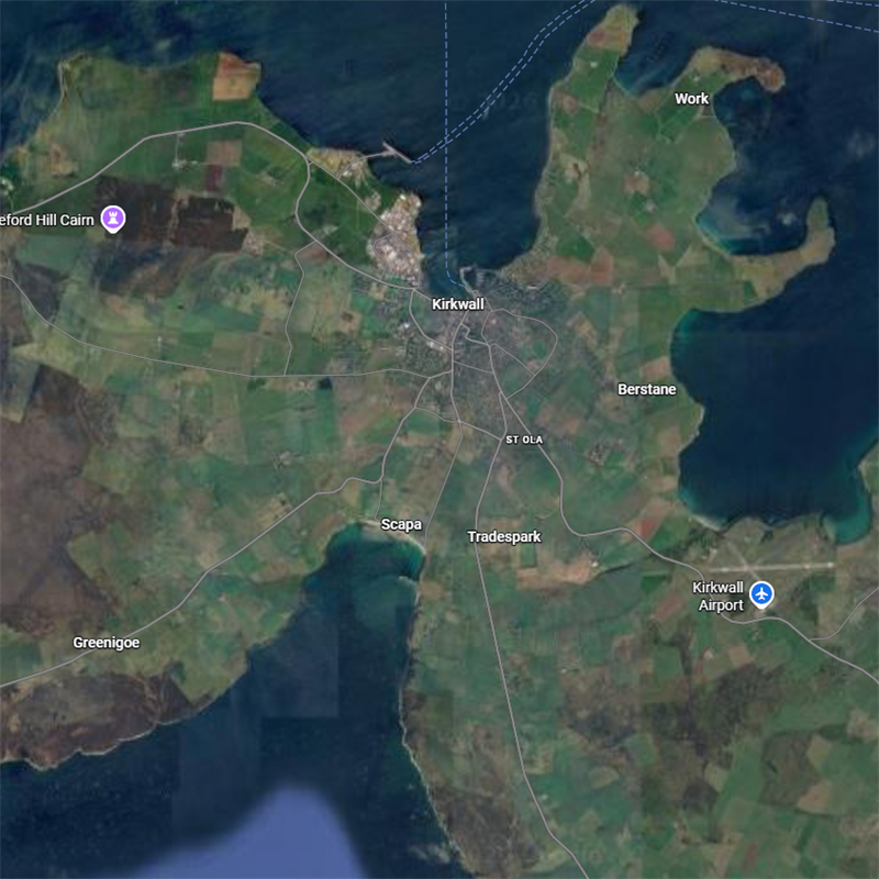
Could be either the bay at the N of Scapa Flow, or the isthmus between Scapa and Kirkwall.
Eið (OWN)
Aith, Stronsay, Orkney
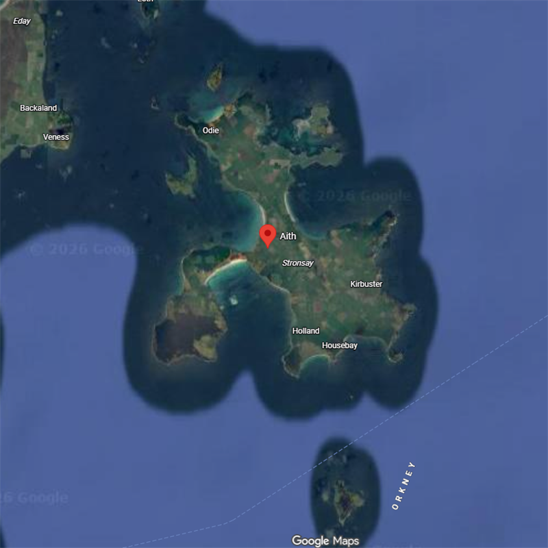
Satíris-eið (OWN)
Kintyre-eið, Kintyre, Scotland
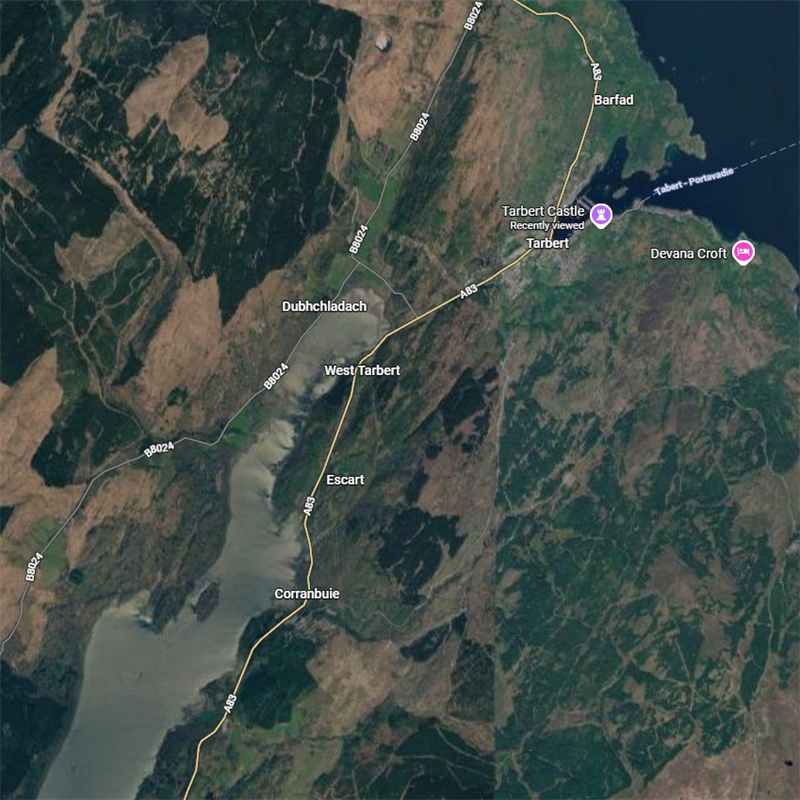
Often misunderstood as Mull of Kintyre whose Gaelic name Maol Chinn Tìre (bare headland) speaks for itself. According to Magnus Berfœtts saga where Kintyre used to be known as Satíri, lét hann draga skútu um Satíriseið (he had a ship pulled over the Kintyre isthmus) which seems to refer specifcally to the 1-mile (1.6 km) land-bridge and portage at Tarbert in the N of the Kintyre peninsula, all the more so since the name is an Anglicisation of Gaelic tairbeart, meaning ‘carrying across’.
Eið (OWN)
Aith, Bressay, Shetland
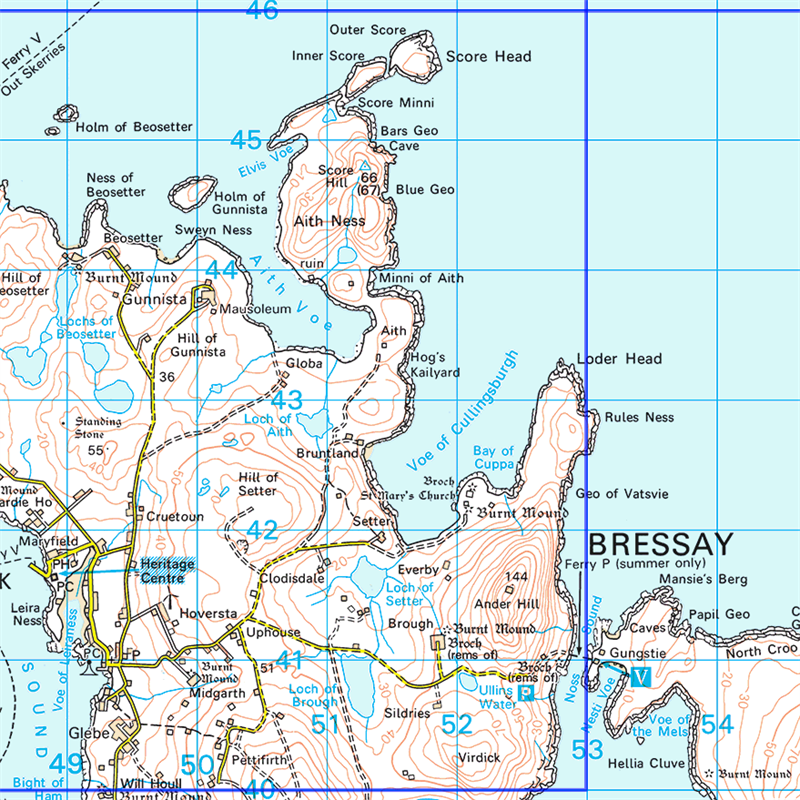
N of Bressay, curving around the SW of Aith Ness promontory / peninsula and abutting ‘Aith’, possibly an ‘isthmus’ leading to Aith Ness; Shetland’s Aiths are often associated with a ‘voe’, Shaetlan (Shetland dialect) for ‘inlet’, from ON vágr (way), itself suggesting the eið was a nautical destination.
Eið (OWN)
Aith, Shetland
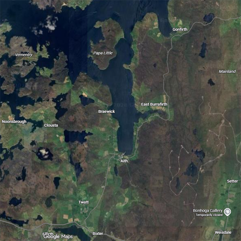
Mainland center, a village/bay at the S of its inlet.
Eið (OWN)
Aith, Shetland
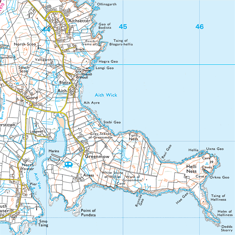
S of Mainland, where Aith could be a bay (wick) just N of said inlet and 600-odd meters S of Aithsetter, a one-time farm on a headland; this is a good example of copy-and-paste error-sprawl: Wikipedia confidently asserts Aithsetter to come from Old Norse: Eiðseti, ‘the farm at the isthmus’ when it’s probably named for being near (but not on) Aith (yes, prob. an isthmus).
Ed (OEN)
Ed, Västra Götaland, Sweden
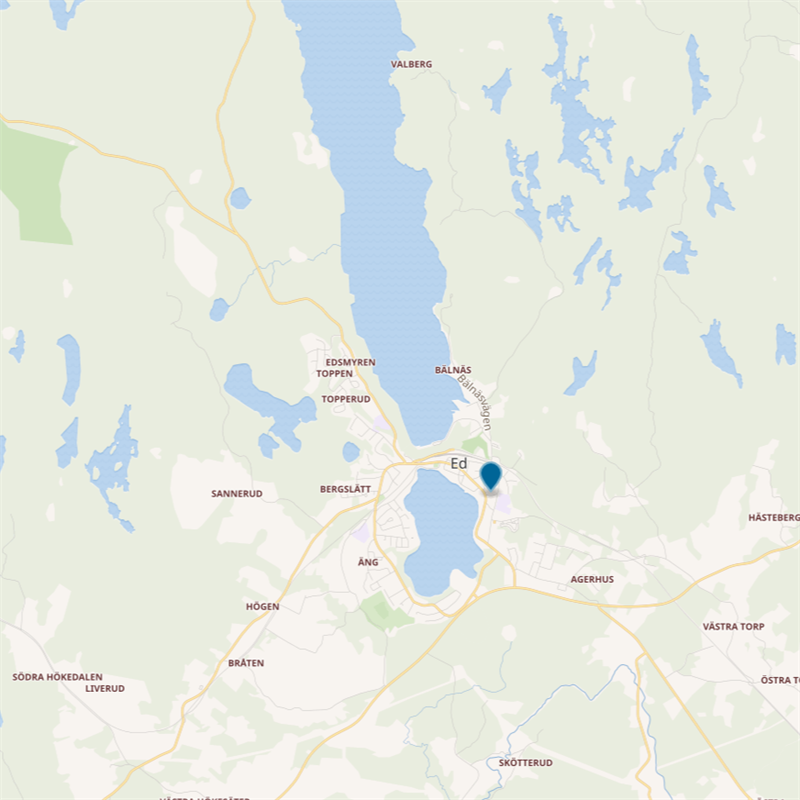
Perhaps the type example of ed, from O.Swed. eþer < ēþ: a neck or passage over a narrow strip of land between navigable waterways, over which a ship can be pulled, the waterways here being Stora Le to the N and Lilla Le to the S.
Kylley / Kyllaj (OG), Hellvi, Gotland
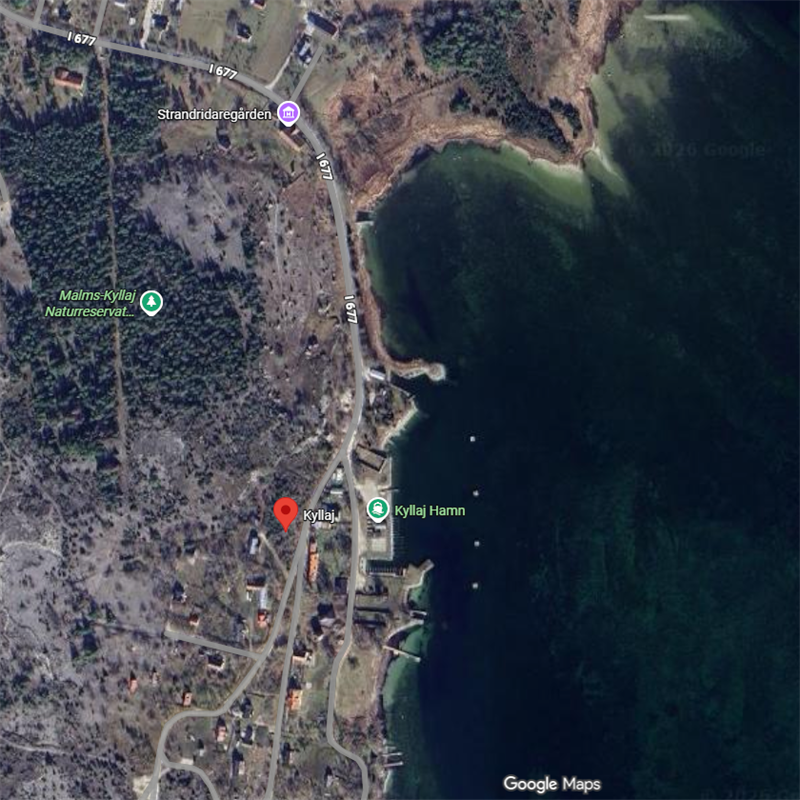
Harbor on the E coast which may have been a landing-beach/bay, “pronounced […] Kyll-aid by the older generation”[4]; not an island so the aid to (very hypothetical) ey to ö switch (see Fyghelde) can be excluded; this is a possible eið candidate
[4] From Säve, C. 1852. Om Gotlands äldsta fornlemningar; in Christine Peel. “Guta Saga – The History of the Gotlanders,” Viking Society for Northern Research Text Series. Vol. XII. Viking Society for Northern Research, University College of London (1999).
Hjorted
Kalmar, Sweden
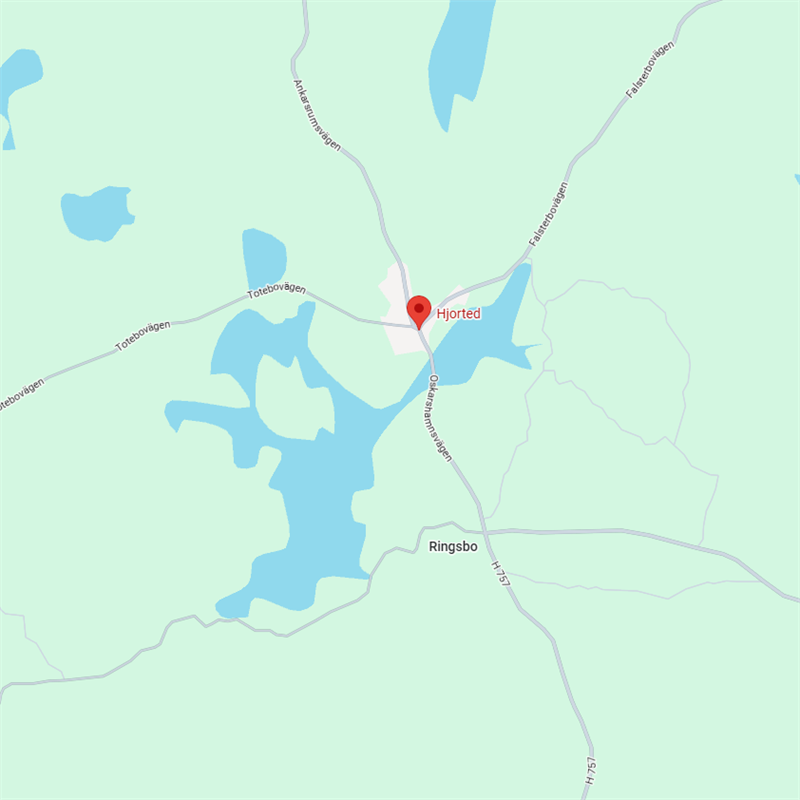
Lit. Hart ed, used here to refer to a passage between or alongside water.
Enlang (OEN)
Östra Lagnö, Sweden
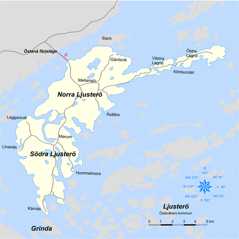
First known as enlang in King Valdemar’s Itinerary; probably a promontory, Lagnö being divided into two halves: the WSW Västra Lagnö and ENE Östra Lagnö.
Edet (OEN)
Västra Götaland, Sweden
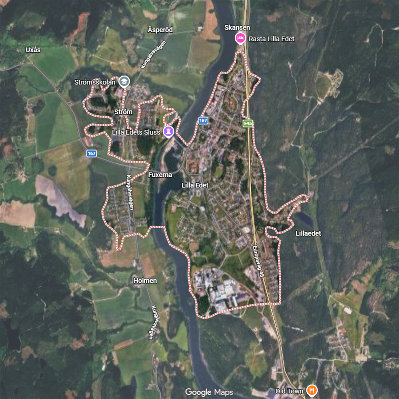
Three names, one locality. Lilla Edet, Stora Edet and Edborg, the latter a one-time fortress on the Göta river, the second now called Trollhättan (qv.), formerly Eidar and Stranna (dialect for Swed. strand, ‘beach’) named for its being a site for portage of boats past the rapids; the area was known as Eiðar, i.e. the plural of Ed, in the 13th C (see Eiðar, Iceland).
Stora Edet (OEN)
Trollhattan, Västra Götaland, Sweden
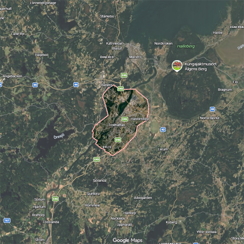
Originally named for being a site for portage of boats past the rapids/falls, akin to its smaller version 20 km downstream (see Lilla Edet).
Αειφορ/Aeifor (?Eið-forr?)
Porych Nenasytets, Ukraine
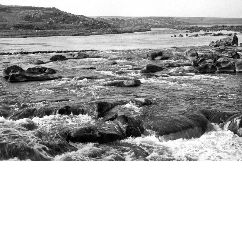
Not a certified eið. Nenasytets was the largest and most dangerous Dnieper rapid, always requiring portage. Its Norse name Aeifor (Constantine VII, De Administrando Imperio c.950) is mainstream-read as Ei-forr 'ever-fierce', but minority support exists for Eið-forr 'portage-cataract' – potentially an early eið-name. Certainty is precluded by the DAI's multilingual transmission chain and a probable Christian-scribal filter over the parallel Slavic name ('pelican'). Suggestive but unresolved. This entry, being significantly more complex than the others, can be read more easily here.